Interpolated with surface topo
Note
Click here to download the full example code
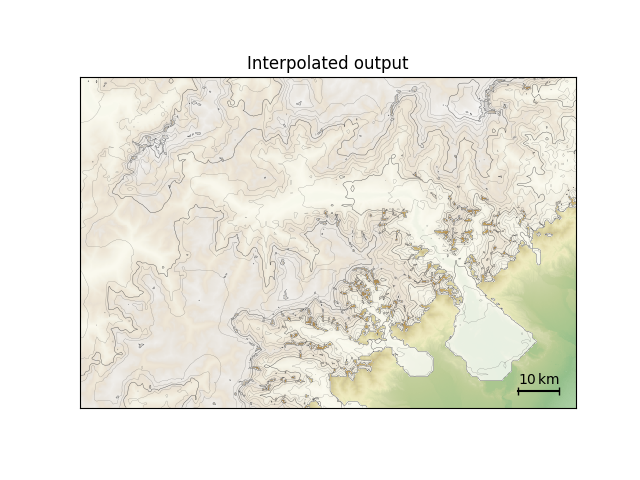
Interpolated with surface topo#
Demonstrate interpolating two-dimensional model output when surface topography, rather than bedrock topography, is present in the original data. The result is the same as in the interpolated output example.
downloading https://raw.githubusercontent.com/juseg/hyoga-data/main/pism/pism.alps.vis.refined.nc...
import matplotlib.pyplot as plt
import hyoga

# initialize figure
ax = plt.subplot()

# open demo data
with hyoga.open.example('pism.alps.out.2d.nc') as ds:

    # compute surface altitude and remove bedrock altitude
    ds['usurf'] = ds.hyoga.getvar('surface_altitude')
    ds = ds.drop('topg')

    # compute isostatic adjustment from a reference input topography
    ds = ds.hyoga.assign_isostasy(hyoga.open.example('pism.alps.in.boot.nc'))

    # perform the actual interpolation
    ds = ds.hyoga.interp(hyoga.open.example('pism.alps.vis.refined.nc'))

    # plot model output
    ds.hyoga.plot.bedrock_altitude(ax=ax, cmap='Topographic', center=False)
    ds.hyoga.plot.surface_altitude_contours(ax=ax)
    ds.hyoga.plot.ice_margin(ax=ax, facecolor='w')

    # add scale bar
    ds.hyoga.plot.scale_bar()

# set title
ax.set_title('Interpolated output')

# show
plt.show()
Total running time of the script: ( 0 minutes 1.819 seconds)